Keyword
Bathymetry and Elevation
184 record(s)
Type of resources
Categories
Topics
INSPIRE themes
Keywords
Contact for the resource
Provided by
Years
Formats
Status
-

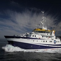
The EM 300 campaign was the first of those carried out by the B / O Vizconde de Eza. The first part of the same was used for the calibration and start-up of the multibeam echo sounder system that the vessel is equipped with, basically consisting of an EM-300 multibeam echo sounder, a Seapath-200 motion sensor, a D Seastar GPS, a GPSD Fugro, a SV Plus sound speed sensor and a Sun Ultra5 workstation, for data acquisition, with a plotter for printing the obtained data.
-

The main objective of the project ATLANTIS is the study of fishing activities and marine resources of commercial interest in the FAO statistical subareas 41.3.1 and 41.3.2, within an ecosystem approach, paying particular attention to interactions between fishing activities and Vulnerable Marine Ecosystems, mainly on the High Seas of the SW Atlantic. From 1988 the IEO scientific observers onboard programme, gives commercial, biological, oceanographic and physical data (bathymetry, surface and sea bed temperatures, etc). A series of research cruises were carried out from 2007, on board the R/V Miguel Oliver, with the main objective of said research cruises was the quantitative, qualitative and geographical study and identification of the Vulnerable Marine Ecosystems and of the vulnerable organisms in the taxonomic groups who could live in the study area, including the proposal of marine areas to be protected, to allow sustainable exploitation of fishing resources without endangering the Vulnerable Marine Ecosystems. During the research cruises undertaken, from the surface to 1,500 m, in the south western Atlantic waters between 42ºS and 48ºS, a variety of data was obtained from the fieldwork on geology, geomorphology, benthos, fisheries and physical oceanography. The results include: a detailed cartographic and bathymetric study of the area, a description of the geological substratum and of the benthic features, an analysis of the abundance and distribution of the species of largest commercial fishing interest, a footprint analysis of the fishery, an identification and a description of the Vulnerable Marine Ecosystems. The research undertaken and its main findings led to the delineating of several areas to be protected, with a total area of 41,000 km2, according to presence of organisms classified as vulnerable.
-

The main objective of the project ATLANTIS is the study of fishing activities and marine resources of commercial interest in the FAO statistical subareas 41.3.1 and 41.3.2, within an ecosystem approach, paying particular attention to interactions between fishing activities and Vulnerable Marine Ecosystems, mainly on the High Seas of the SW Atlantic. From 1988 the IEO scientific observers onboard programme, gives commercial, biological, oceanographic and physical data (bathymetry, surface and sea bed temperatures, etc). A series of research cruises were carried out from 2007, on board the R/V Miguel Oliver, with the main objective of said research cruises was the quantitative, qualitative and geographical study and identification of the Vulnerable Marine Ecosystems and of the vulnerable organisms in the taxonomic groups who could live in the study area, including the proposal of marine areas to be protected, to allow sustainable exploitation of fishing resources without endangering the Vulnerable Marine Ecosystems. During the research cruises undertaken, from the surface to 1,500 m, in the south western Atlantic waters between 42ºS and 48ºS, a variety of data was obtained from the fieldwork on geology, geomorphology, benthos, fisheries and physical oceanography. The results include: a detailed cartographic and bathymetric study of the area, a description of the geological substratum and of the benthic features, an analysis of the abundance and distribution of the species of largest commercial fishing interest, a footprint analysis of the fishery, an identification and a description of the Vulnerable Marine Ecosystems. The research undertaken and its main findings led to the delineating of several areas to be protected, with a total area of 41,000 km2, according to presence of organisms classified as vulnerable.
-

Get more information regarding the characteristics and distribution of benthic habitats present inside the Columbretes Islands Marine Reserve with the objective of Develop a bionomic map that covers the total extent. The complementary objective is the realization of the benthic cartography. It is intended to achieve location and subsequent georeferencing of the upwelling of gases present in the environment of the volcanic archipelago that forms The study area of this campaign. Associated with this objective is intended to know the Bacterial community in the area of gaseous upwellings and a physicochemical characterization of these areas.
-

Realization of virtual 3D scenarios of the most characteristic and vulnerable habitats of the Cabrera Islands National Maritime-Terrestrial Park . Make recordings by means of optical sensors (photographic and video cameras) on the vulnerable and representative benthic habitats, present within the limits of the National Park. In addition, the first sea trials of the underwater photogrammetry module that is being designed and developed within this project will be carried out.. Additionally, samples will be carried out focused on mapping the bottom by means of a multibeam probe of the study area in high resolution. This will allow the underwater vehicle to be operated safely by having a detailed mapping of the areas where the dives will be carried out and obtaining high-detail bathymetries of the areas of interest.
-

Study of the edge of Spanish Platform on the Canary Islands Basin.
-

Study of different sectors of the Mediterranean margins of Andalusia to analyze the potential existing active tectonic structures, capable of generating geological risks either due to the generation of earthquakes, or secondarily due to the triggering of landslides and / or tsunamis.
-

Bathymetry and seismic work on the coast of the island of Menorca (Baleares Islands)
-

The main objective of the project ATLANTIS is the study of fishing activities and marine resources of commercial interest in the FAO statistical subareas 41.3.1 and 41.3.2, within an ecosystem approach, paying particular attention to interactions between fishing activities and Vulnerable Marine Ecosystems, mainly on the High Seas of the SW Atlantic. From 1988 the IEO scientific observers onboard programme, gives commercial, biological, oceanographic and physical data (bathymetry, surface and sea bed temperatures, etc). A series of research cruises were carried out from 2007, on board the R/V Miguel Oliver, with the main objective of said research cruises was the quantitative, qualitative and geographical study and identification of the Vulnerable Marine Ecosystems and of the vulnerable organisms in the taxonomic groups who could live in the study area, including the proposal of marine areas to be protected, to allow sustainable exploitation of fishing resources without endangering the Vulnerable Marine Ecosystems. During the research cruises undertaken, from the surface to 1,500 m, in the south western Atlantic waters between 42ºS and 48ºS, a variety of data was obtained from the fieldwork on geology, geomorphology, benthos, fisheries and physical oceanography. The results include: a detailed cartographic and bathymetric study of the area, a description of the geological substratum and of the benthic features, an analysis of the abundance and distribution of the species of largest commercial fishing interest, a footprint analysis of the fishery, an identification and a description of the Vulnerable Marine Ecosystems. The research undertaken and its main findings led to the delineating of several areas to be protected, with a total area of 41,000 km2, according to presence of organisms classified as vulnerable.
-

The main objective of the project ATLANTIS is the study of fishing activities and marine resources of commercial interest in the FAO statistical subareas 41.3.1 and 41.3.2, within an ecosystem approach, paying particular attention to interactions between fishing activities and Vulnerable Marine Ecosystems, mainly on the High Seas of the SW Atlantic. From 1988 the IEO scientific observers onboard programme, gives commercial, biological, oceanographic and physical data (bathymetry, surface and sea bed temperatures, etc). A series of research cruises were carried out from 2007, on board the R/V Miguel Oliver, with the main objective of said research cruises was the quantitative, qualitative and geographical study and identification of the Vulnerable Marine Ecosystems and of the vulnerable organisms in the taxonomic groups who could live in the study area, including the proposal of marine areas to be protected, to allow sustainable exploitation of fishing resources without endangering the Vulnerable Marine Ecosystems. During the research cruises undertaken, from the surface to 1,500 m, in the south western Atlantic waters between 42ºS and 48ºS, a variety of data was obtained from the fieldwork on geology, geomorphology, benthos, fisheries and physical oceanography. The results include: a detailed cartographic and bathymetric study of the area, a description of the geological substratum and of the benthic features, an analysis of the abundance and distribution of the species of largest commercial fishing interest, a footprint analysis of the fishery, an identification and a description of the Vulnerable Marine Ecosystems. The research undertaken and its main findings led to the delineating of several areas to be protected, with a total area of 41,000 km2, according to presence of organisms classified as vulnerable.
 Catálogo de datos del IEO